Trail Impacts
Contractors for the City of Norfolk’s Office of Resilience, Norfolk Resilience Partners, are doing survey work on streets (in the right-of-way) and on a limited number of private properties to support the Resilient Norfolk Coastal Storm Risk Management Project. You may see workers on or near the Elizabeth River Trail doing work now (February 2024) through April 2024. These investigations are critical to assist the City in developing a design and timeline for this phase of the project as construction is tentatively planned to begin summer 2027.
The Resilient Norfolk Project is a partnership between the City of Norfolk and the U.S. Army Corps of Engineers to help protect the city from major coastal storm events like hurricanes or nor’easters through the construction of features that will reduce coastal flood risk and impacts.
Trail Updates
November 4 – December 31, excluding City of Norfolk Holidays and events at Town Point Park.
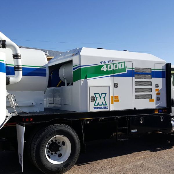
- Work description: Crews will be excavating test holes to locate and identify underground utilities. They will be using a vacuum truck (image below) to extract the dirt to access the utilities.
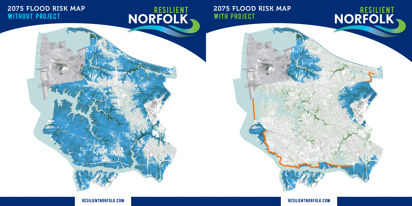
- Location: Along Water Street and the ERT under the 264 overpass. Along the Downtown waterfront, Otter Berth area and Waterside Drive. Please see the attached maps for reference.
- Impact to trail users: ERT trail users will see workers excavating test holes throughout the area in various locations. A VacMaster 4000 will be parked on the ROW on or near the trail to assist with removing dirt from the holes to test for utilities. The vacuum hose will not cross or block the ERT, but the truck will be moved across the trail to the other side when they need to test holes there. We will have cones around the truck and spotters on the trail when we need to move the truck to the other side of the trail. There are some proposed test hole locations on the trail and portable equipment will be used to allow passage of trail users. The holes are about 1’ x 2’ in size and will be restored to existing conditions after testing. For the few test holes on or near the edge of the actual trail traffic cones will be used around the truck and spotters will be on the trail to direct users around the work.
About the Resilient Norfolk Coastal Storm Risk Management Project
The City of Norfolk is increasingly at risk of flooding and damage from coastal storms.
The Coastal Storm Risk Management (CSRM) Project, called Resilient Norfolk, is a collaboration between the US Army Corps of Engineers and the City of Norfolk to reduce the City’s risk from coastal flooding and damage from nor’easters, hurricanes, and other significant storm events.
Learn more about Resilient Norfolk, visit www.resilientnorfolk.com.


