Imagining, Growing, Bridging
On a cool late April afternoon, I met a contingent of Virginia Beach citizens, ATAC (Active Transportation Advisory Committee) members, business leaders, and the Chief Planner from VB Parks and Recreation at the Newtown Transit Hub to walk the corridor of our future VB Trail.
Now, as ERT users and commuters arrive at the Newtown Transit Hub by Tide, bus, bike, or on foot, they disembark at a busy intersection. For years, we’ve witnessed people already using this abandoned rail corridor, if only because it was the safest place to traverse on foot or by bike. By 2027, we’ll be able to write a different story as the VB Trail takes shape.

Less than half a mile from Sentara Leigh’s campus the VB trail moves quickly from a commercial corridor to a light industrial zone where ECPI, ATI, Fortis College, and many other skilled trade centers are located creating an educational corridor, much like ERT’s linked corridor of NSU, TCC, ODU/EVMS. In this current stretch of roadway, you’ll find students who are primarily female veterans seeking credentialing in the skilled trades (ATI offers CDL certifications). The VB Trail will take this dark corridor lined with trucks to a lit, thriving, safe zone for people who are looking to improve their lives, and can easily access school even without a vehicle.
In this tract of corridor, there remains a quaint white picket fence and the remnants of a barn, the last remaining farm in this area of Virginia Beach. Our guide encourages the group to imagine this soon-to-be-for-sale acreage as a vibrant trailside restaurant/brewery and farm market and makes reference to the ERT’s Chelsea district. The transition to a tree-lined sweep, a residential buffer, is sudden, and the trail opens up before us in a stretch of railbed, and it’s easy to see this rail-to-trail corridor take shape.
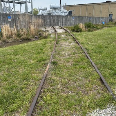
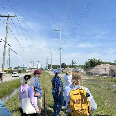
Continuing our walk, we saw elementary schools, neighborhoods and multi-family apartments under construction and already full of residents based on the promise of this future trail. This vision and forward-thinking monetary commitment risked by the private market means they understand this is a major economic development project.
It’s easy to see this long stretch of railbed booming with access, amenities, restaurants and retail. Much like the Swamp Rabbit Trail in Greenville, SC, the community blooms around the trail with markets, shops, residences, and not surprisingly an increase in resident quality of life. Isn’t that truly what this is about? Again, and again resident surveys tell us that this is what people are missing and want. A safe place to walk and to connect.
This past month alone there’s been media in the Daily Press on the South Hampton Roads Trail, in the Virginian Pilot on the same, emphasizing some needs on the Chesapeake portion, and then just days ago we shared in the celebration of our friends on the Eastern Shore Rail Trail breaking ground on their long awaited 49 mile trail connecting Cape Charles to Cheritan. Our neighbors in Suffolk are working on final phases of the completion of the Suffolk Seaboard Coastline Trail, the only project in Virginia to receive RAISE grant funding in 2024.
Just a couple weeks after this VB Trail field trip, I joined trail and land conservation professionals from all over the Commonwealth for the Vault (Virginia United Land Trust) Parks and Greenways Conference in Lynchburg, VA. This annual conference is a highlight for me, and I’ve had the distinct pleasure of presenting at the last few conferences. This year the organizers took care to craft a session that brought together a full picture of the progressive regional work that is happening in Hampton Roads.
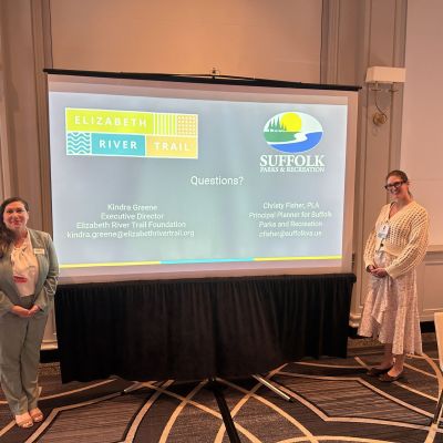
I shared a timeslot with colleagues I get to work with through the HRTPO Joint Active Transportation Subcommittee. Kevin Finn, Comprehensive Planning Administrator for the City of Chesapeake, (and Chair of the JATS) presented on Pathways to Access and Planning for Citywide Trails. I presented alongside Christy Fisher, Principal Planner for Suffolk Parks and Recreation. Together we discussed Creative Trail Funding Strategies for Municipalities and Nonprofits.
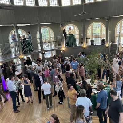
All three of us separately shared maps of the South Hampton Roads Trail and the VB Trail. It was clear to all in the audience that big things are happening in Hampton Roads and that the area will be a destination for connected trail systems. We’ve been talking for decades about regionalism in Hampton Roads. Does it start with businesses, City Managers, philanthropists, Universities? Yes, of course, all of those things, but I argue that the folks leading this effort and vision for regionalism have been the people planning for trails and those that support them. A connected region can happen through a trail system. Everyone can be a part of this story. Our individual responses and strengths need collective energy and with that I believe Hampton Roads regionalism will happen through a trail system.
Back to that cool day on the future VB Trail as we walked our last 1/3 of a mile into Town Center. As we stood where the future pedestrian bridge over Independence Blvd. will need to begin its foundation to start its incline, it seemed an apt metaphor for what trails do for communities. They bridge us. As this bridge will vastly diminish bike and pedestrian interactions and fatalities, they provide a safe place for connection. They do what all parks and green spaces and recreation should do, improve quality of life for all.


